
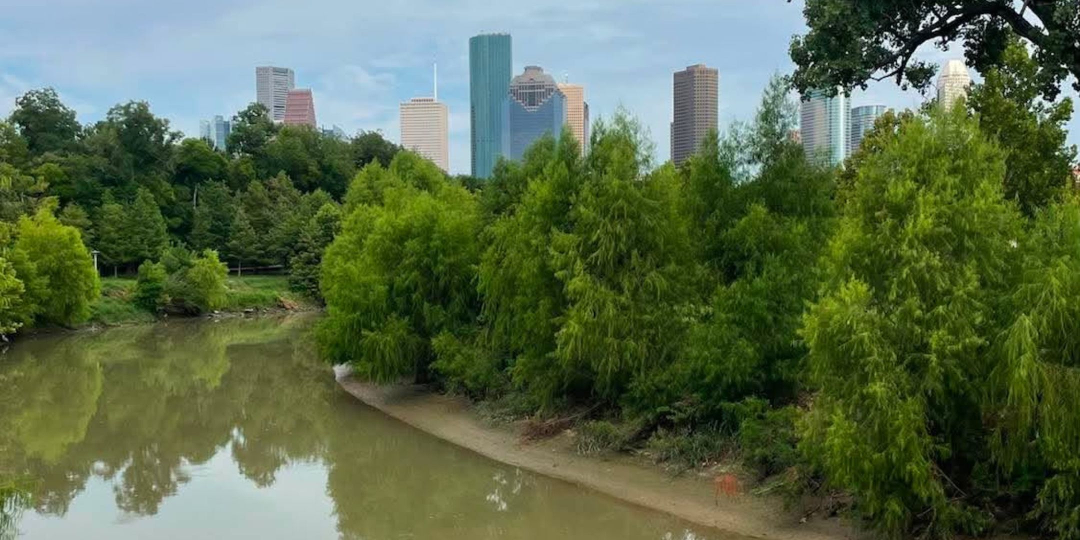

Every Houstonian has cross one.
Whether it’s Buffalo Bayou winding through downtown, Brays Bayou near the Texas Medical Center, or White Oak Bayou stretching through the Heights, the city’s bayous are impossible to avoid. They appear beneath freeways, behind neighborhoods, beside parks, and throughout nearly every corner of the region.
Yet despite seeing them almost every day, few people stop to ask a simple question:
Why does Houston have so many bayous?
The answer reaches back thousands of years, long before skyscrapers, freeways, oil wells, or even the founding of Texas. In many ways, Houston exists because of its bayous.
More Than Just Creeks
A common misconception is that a bayou is simply another word for a creek.
Not quite.
A bayou is a slow-moving natural waterway found in flat, low-lying landscapes. Unlike rivers that rush through steep valleys, bayous gently wind across broad coastal plains, often connecting wetlands, streams, lakes, and eventually larger rivers or bays.
The word itself is believed to have originated from the Choctaw language, describing a small stream or slow-moving waterway, and today it has become one of the defining characteristics of the Gulf Coast.
Houston just happens to have one of the largest networks anywhere.
Why Houston Has So Many Bayous
Houston wasn’t designed around the bayous.
The bayous designed Houston.
Thousands of years ago, rainfall slowly carved shallow channels across the coastal prairie that would eventually become Southeast Texas. Unlike the rocky terrain found in many parts of the country, Houston sits on an incredibly flat coastal plain with clay-rich soils that don’t absorb water quickly.
When heavy rains fall, the water has nowhere to rush.
Instead, it spreads across the landscape and gradually collects into slow, winding channels that make their way toward the Gulf of Mexico.
Over centuries, those channels became the network of bayous that still define Houston today.
Rather than relying on one dominant river, Houston developed dozens of natural waterways that together drain one of the largest metropolitan areas in the United States.

Why Houston Became the Bayou City
Houston isn’t known as the Bayou City simply because it has many bayous.
It’s because the city was founded on one.
In 1836, brothers Augustus Chapman Allen and John Kirby Allen purchased land along Buffalo Bayou with a bold vision.
While much of the area appeared to be little more than marshland, the Allen brothers recognized something others overlooked.
Buffalo Bayou offered access to transportation.
Although large ocean-going ships could not yet navigate the shallow waterway, smaller vessels could carry supplies inland. They believed the location could eventually become one of the most important trading centers in Texas.
History proved them right.
That decision eventually led to the development of the Houston Ship Channel, transforming Houston from a frontier settlement into one of the world’s busiest ports and laying the foundation for the city’s rise as the Energy Capital of the World.
It all started with a bayou.
Houston’s Network of Bayous
Most people recognize only Buffalo Bayou, but it is just one piece of a much larger system.
The Houston region contains more than twenty major bayous and countless smaller tributaries that stretch across Harris County and beyond.
Some of the best-known include:
- Buffalo Bayou
- White Oak Bayou
- Brays Bayou
- Greens Bayou
- Sims Bayou
- Halls Bayou
- Cypress Creek
- Clear Creek
Together, these waterways create hundreds of miles of natural drainage corridors that continue to shape how Houston grows and functions today.
Are the Bayous Responsible for Flooding?
The answer may surprise many people.
The bayous themselves are not the problem.
They’re actually Houston’s natural defense against flooding.
When heavy rains fall, the bayous collect and carry enormous volumes of water toward Galveston Bay and the Gulf of Mexico. Flooding occurs when rainfall arrives faster than those waterways can move it downstream.
Modern development has also changed the equation.
As Houston expanded, millions of acres of prairie and farmland gave way to roads, parking lots, rooftops, and neighborhoods. These hard surfaces prevent rainwater from soaking into the ground, sending much larger amounts of runoff into the bayous in a much shorter period of time.
Without Houston’s extensive bayou system, flooding would likely be even more severe.
More Than Waterways
Today, Houston’s bayous serve purposes far beyond drainage.
Many have become recreational corridors featuring parks, hike-and-bike trails, kayaking, wildlife habitats, public art, and gathering spaces enjoyed by millions of residents each year.
Places like Buffalo Bayou Park have transformed what was once viewed simply as flood infrastructure into some of the city’s most celebrated public spaces.
The bayous remain both practical and beautiful, quietly connecting Houston’s past with its future.
The Waterways That Built a City
It’s easy to look at Houston’s skyline and assume the city’s success was built by oil, medicine, aerospace, or shipping.
Those industries certainly transformed Houston into the global city it is today.
But before any refinery was built, before the first freeway stretched across the prairie, before astronauts trained nearby or the Texas Medical Center became the largest medical complex in the world, there were the bayous.
They carried the water.
They guided commerce.
They determined where Houston would be founded.
Every day, millions of people cross bridges over Buffalo, Brays, White Oak, Greens, Sims, and dozens of other bayous without giving them a second thought.
Yet these quiet waterways are far more than landmarks on a map.
They are the original blueprint of Houston.
Long before the skyline reached toward the clouds, the bayous showed a young city exactly where to grow.